Big Bang Lithium
The 6,267-hectare Big Bang Lithium property consists of 17 mineral claims within the Thunder Bay Mining Division and is located approximately 70 km east of Rock Tech Lithium’s advanced-stage Georgia Lake property which hosts a 10.60 MT @ 0.88% Li2O Indicated Resource and a 4.22 MT @ 1.00% Li2O Inferred Resource with production targeted for H2 - 2024.
Director & Interim CEO Steve Roebuck:
“Big Bang is a very exciting property with pegmatites having been mapped on surface and intersected in three drill holes. The 1968 drill program was focused on assessing the uranium potential of the pegmatite with no attention paid to the lithium potential. The 55-year-old drill logs are vague and contain no details about the mineralogical composition of the pegmatite but the macro geological and structural conditions, in and around the property, create favourable conditions for lithium bearing minerals to be present. High Tide will conduct a site visit in the spring to assess the area and prepare for a summer exploration program.”
The property is underlain by a muscovite-bearing, S-type, peraluminous, fertile granite intruding metasediments. The Property occurs within 3 km of a subprovince boundary, and the Long Lac Fault and secondary structures provide excellent pathways for granitic melts and pegmatite deposition. Mapping in the Big Bang area in 1939 identified several instances of ‘granite’ pegmatite. However, mapping during this era did not recognize, or document, various other ‘types’ of pegmatites which contain important mineralogical information.
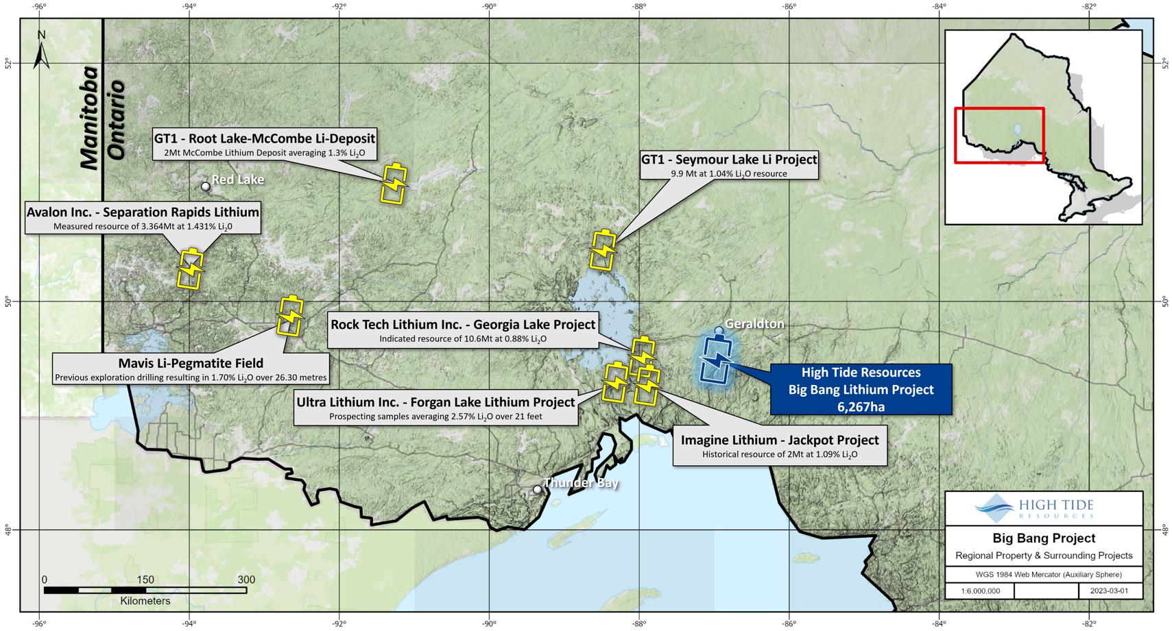
Figure 1:Big Bang Lithium Project location map in NW Ontario, Canada
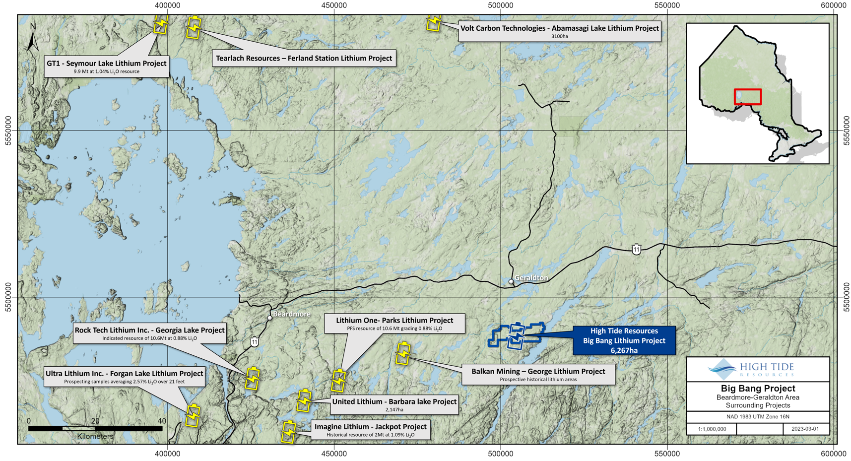
Figure 2: Big Bang Lithium Project east of the Georgia Lake Lithium area
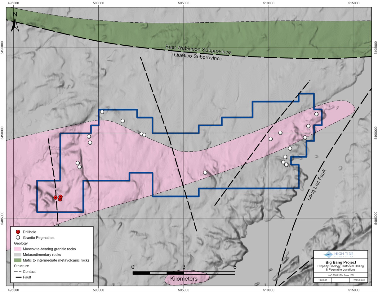
Figure 3: Location of surface mapped pegmatites from 1939 and 3 drill holes collared in 1968 testing uranium potential of pegmatites
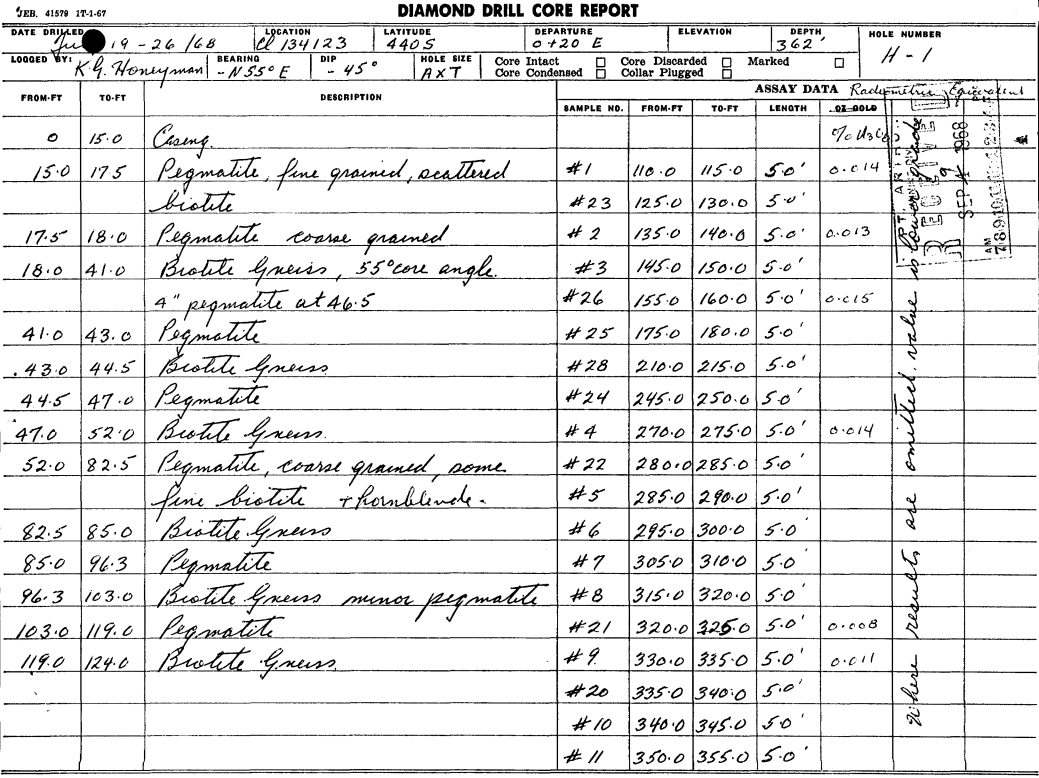
Figure 4: Chimo Option – July 1968 - Drill Log H1 - uranium exploration (1 of 2) – pegmatite noted
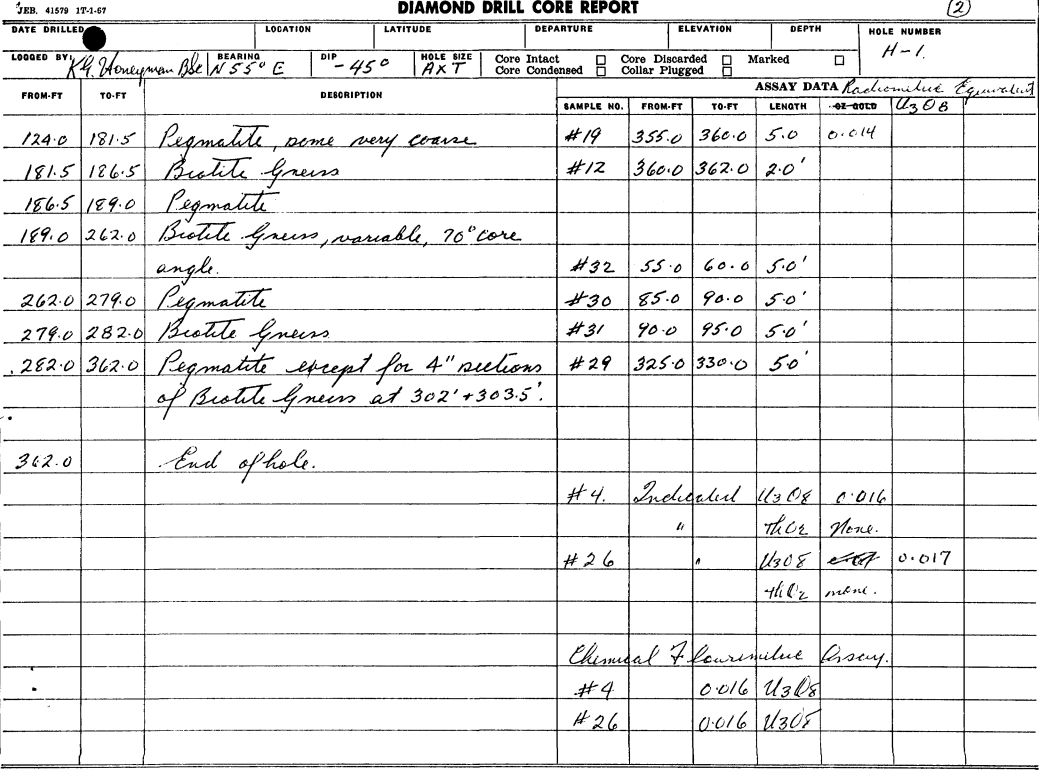
Figure 5: Chimo Option – July 1968 - Drill Log H1 - uranium exploration (2 of 2) – pegmatite noted