
Labrador West Iron Project
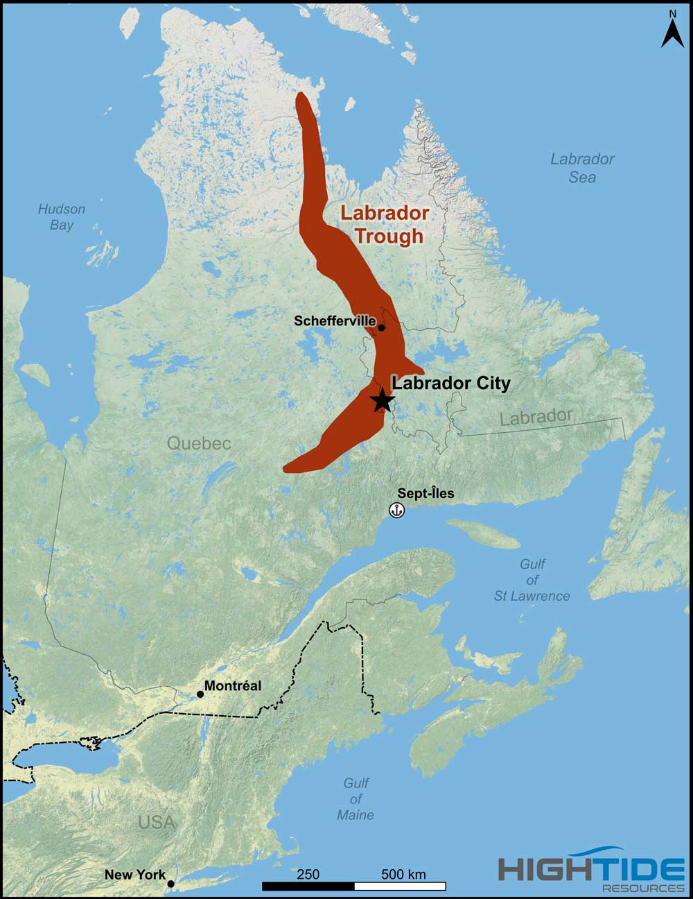
Map 1: Location Map
Labrador Trough Overview
Canada’s Labrador Trough is a world class, high purity iron ore district spanning western Labrador and northeastern Québec. More than 60 years of continuous, profitable production have delivered over 2 billion tonnes of iron ore from oxide facies iron formation. The district remains highly prospective, supported by extensive, laterally continuous deposits characterized by high quality, low impurity levels, and strong scalability.

Map 2: The Infrastructure Advantage
High Tide Resources’ Labrador West Iron Project is positioned to help meet growing domestic and international demand for premium iron ore. The Project benefits from established regional infrastructure, including reliable and low-cost renewable hydroelectric power, direct rail connections to deep water ports, and a skilled mining workforce in Labrador City and Wabush. These advantages, combined with modern, energy efficient processing technologies, support a development pathway aligned with emerging green steel supply chain requirements.

Map 3: Southern Labrador Trough Mining Camp
High Tide Resources is advancing its flagship Labrador West Iron Project, located in the southern Labrador Trough among four established iron ore operations: Rio Tinto and Mitsubishi’s Carol Lake Mine, Champion Iron’s Bloom Lake Mine, ArcelorMittal’s Mont Wright Mine, and Tacora Resources’ Scully Mine. The Project was originally explored and drilled by Rio Tinto Exploration between 2010 and 2012, with additional drilling completed by High Tide in 2020 and 2022. Between 2010 and 2022 approximately 7800 metres of HQ and NQ core have been drilled.
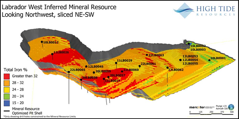
Image 1: 2023 Labrador West Deposit Block Model Showing Grade, Drilling and Pit-Constrained Resource Outline
In February 2023, the Company announced a maiden mineral resource estimate of 655 Mt at 28.8% Fe in the Inferred category. The 2026 program is designed to expand the resource to over 1 billion tonnes and upgrade it from Inferred to Indicated through a combination of step out and infill drilling. Parallel workstreams include detailed metallurgical testwork, ongoing environmental baseline studies, and advanced geological modelling—collectively forming the foundation for a Preliminary Economic Assessment targeted for early to mid 2027.
The development path for the Labrador West Iron Project focuses on steadily increasing geological confidence while reducing technical risk through sustained drilling intensity in the coming years. Metallurgical testing completed to date indicates that a high quality concentrate can be produced using gravity separation, with results comparable to other successful iron ore operations in the region.

Map 4: Property Scale Map highlighting 2026 drill collar locations – over 6300m drilled in 2026
Assay Results released through September 16, 2026 include.
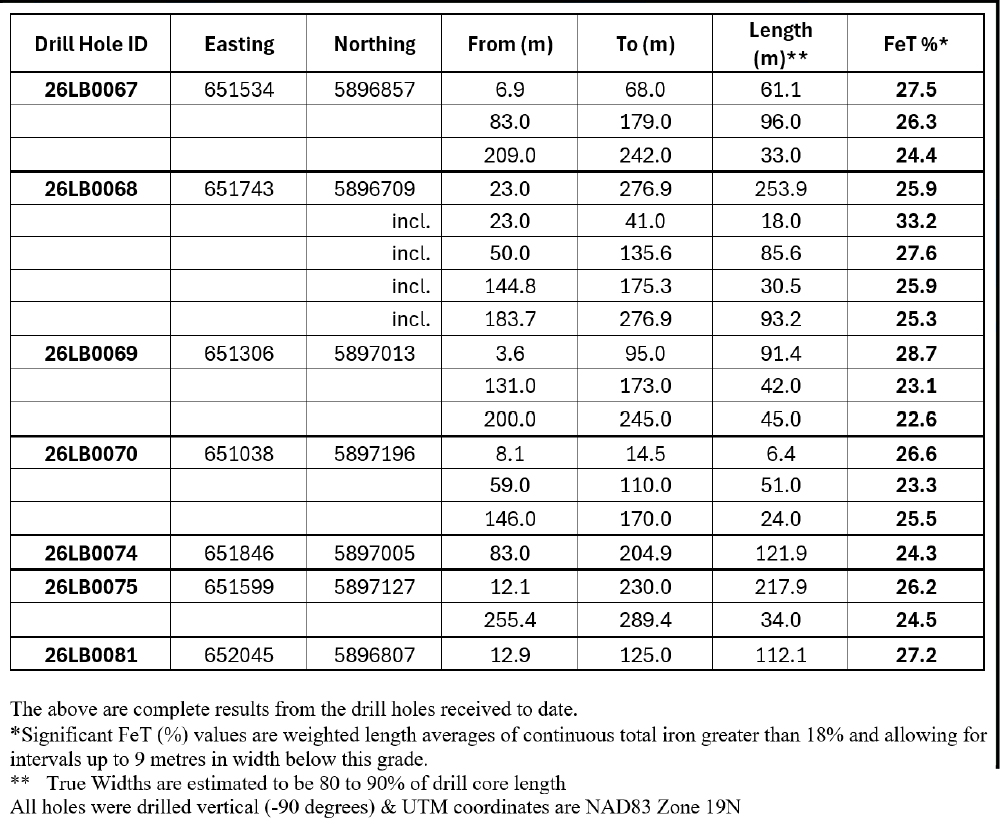
Table A: Significant Iron Intercepts reported on August 31, 2026

Table B: Significant Iron Intercepts reported on Sept 16, 2026
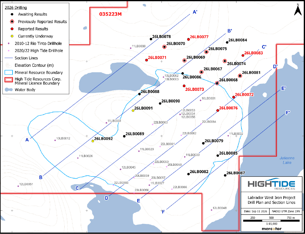
Map 5: Plan Map showing 2023 mineral resource boundary and 2026 drill collars, plus location of vertical sections – all vertical sections are looking to the northwest vertical long sections corresponding to Map 5 showing drill hole traces and assay results from 2026 drill program.
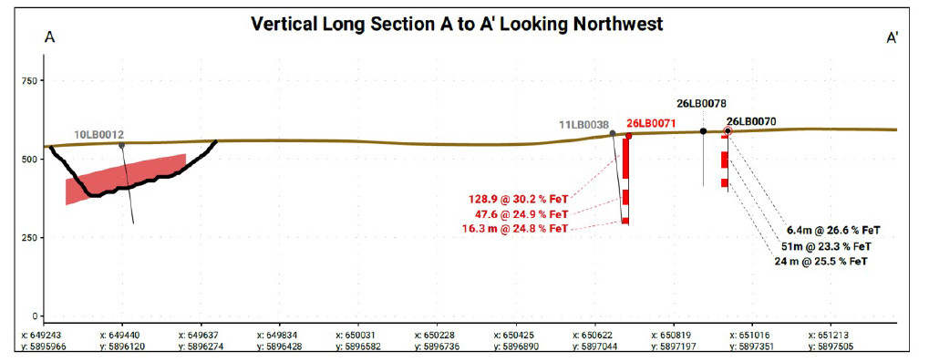
Figure 1. Labrador West Project – Long section A – A’
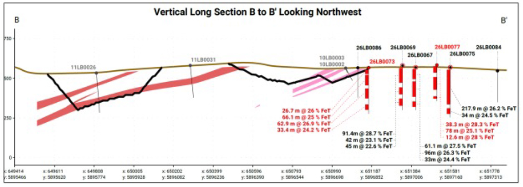
Figure 2. Labrador West Project – Long section B – B’
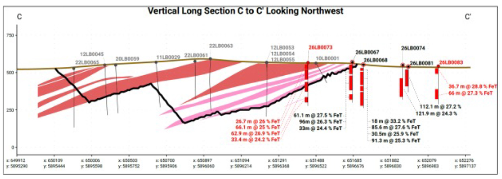
Figure 3. Labrador West Project – Long section C – C’
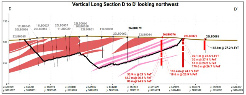
Figure 4. Labrador West Project – Long section D – D’
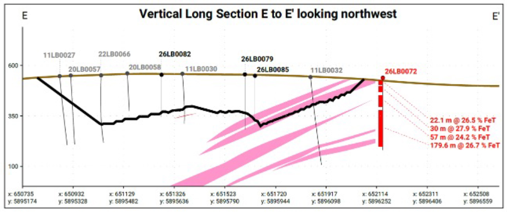
Figure 5. Labrador West Project – Long section E – E’
Technical Report
• 2023-01-31
High Tide Resources NI 43-101 Report Mineral Resource Estimate Labrador West Iron
• 2020-11-20
High Tide Resources NI 43-101 Report Labrador West Iron
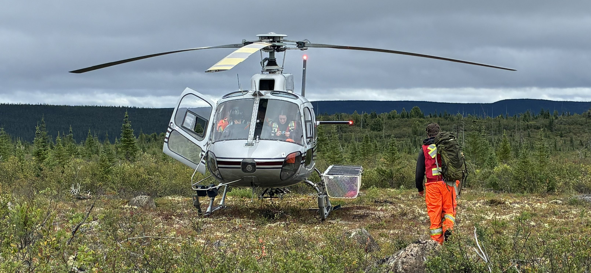
Helicopter at Labrador West Iron Project
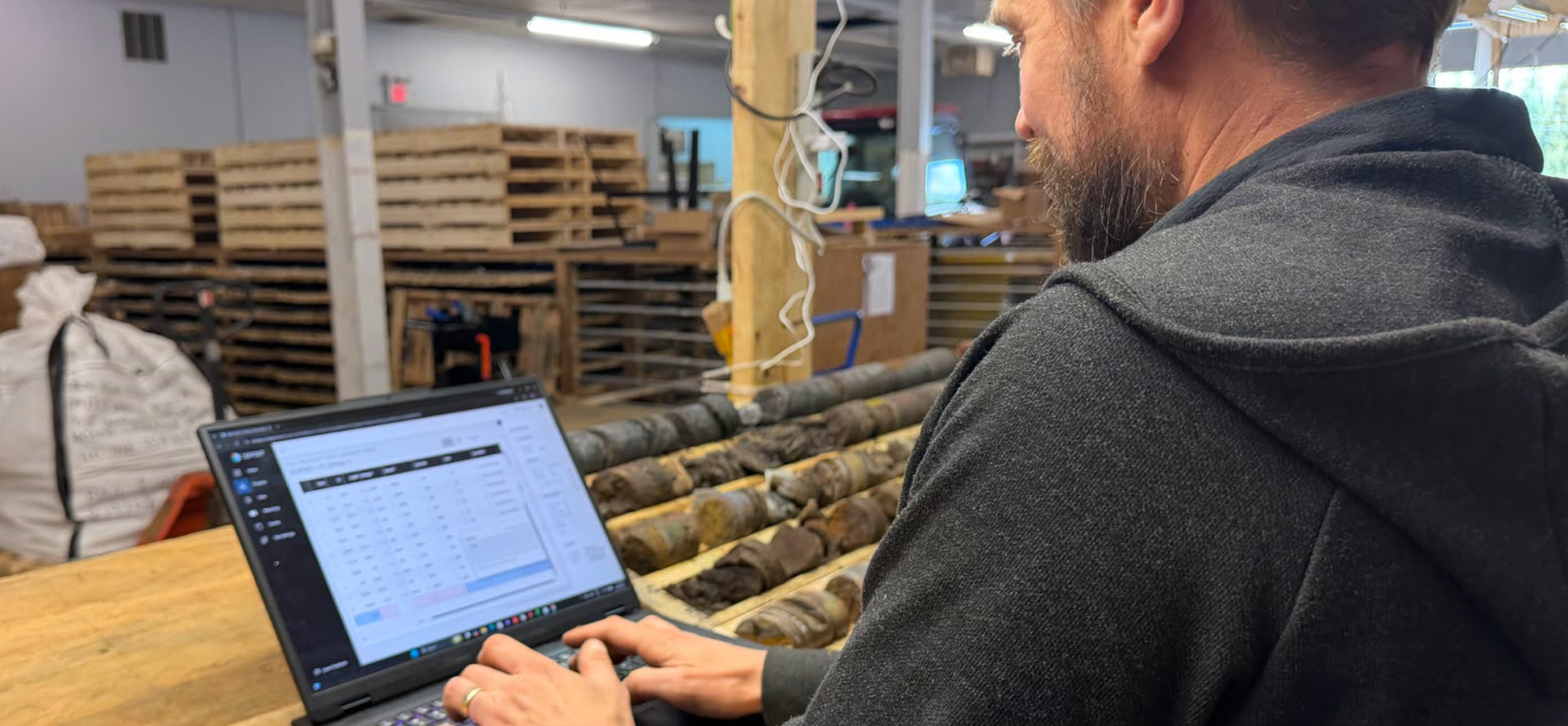
Geologist (Project QP) logging drill core

Geological technician splitting drill core
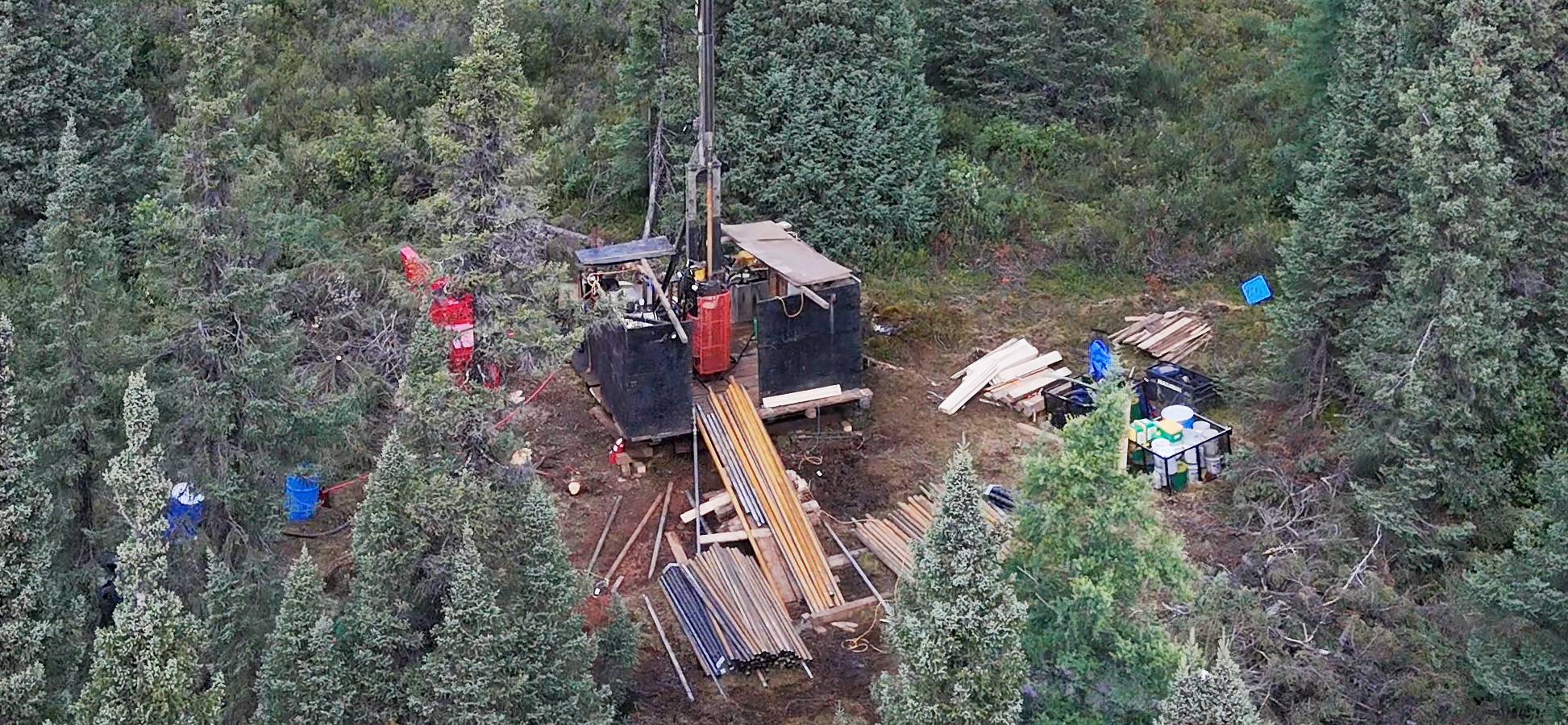
Drill Rig drilling vertical hole
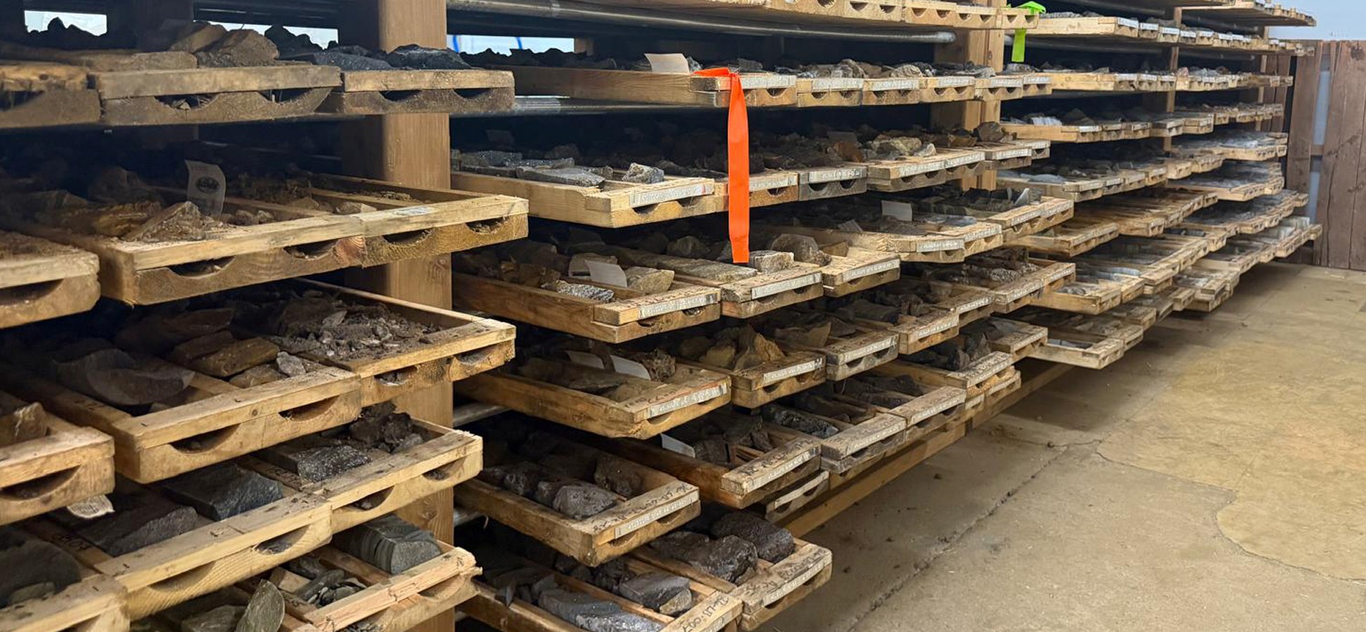
Drill Core in core racks

Magnetic Drill Core
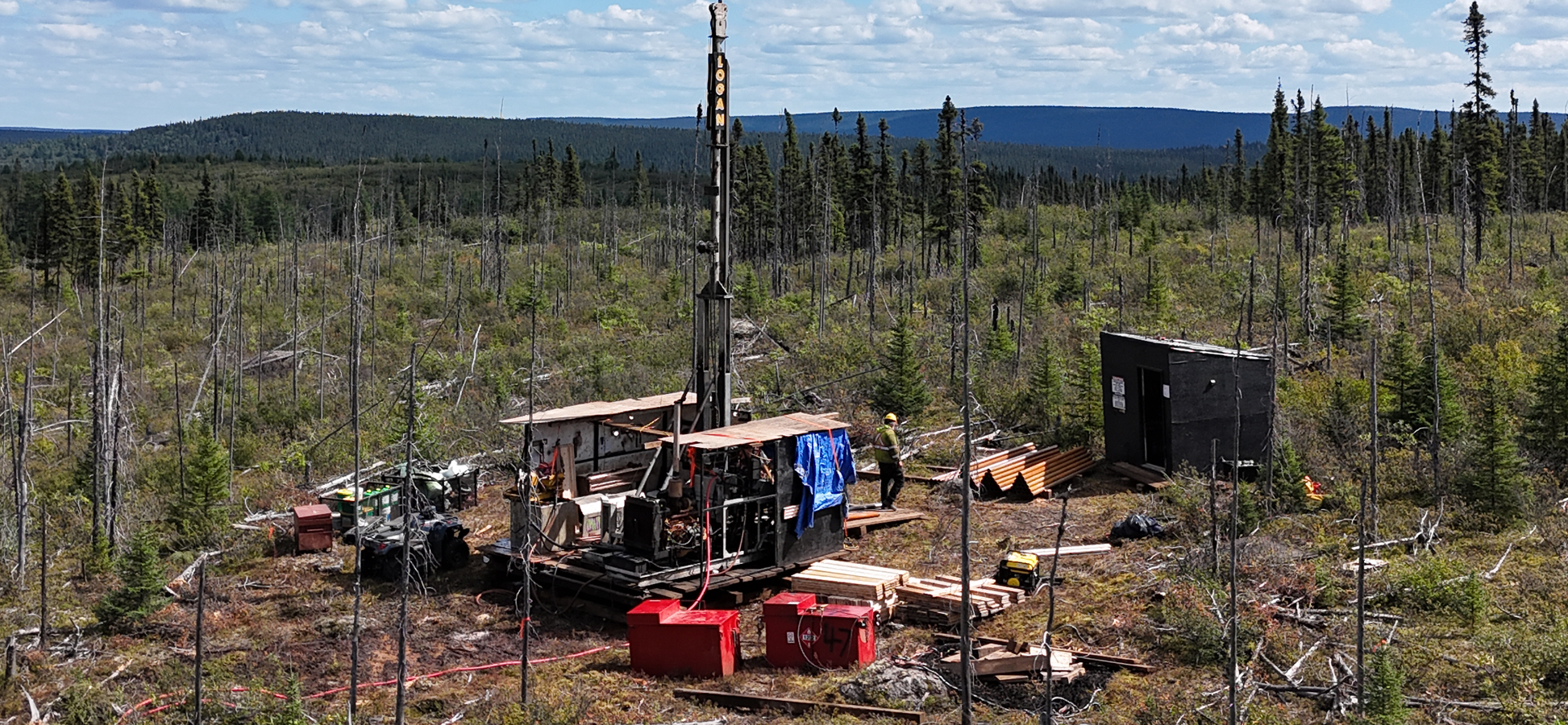
Drill Rig as seen from drone
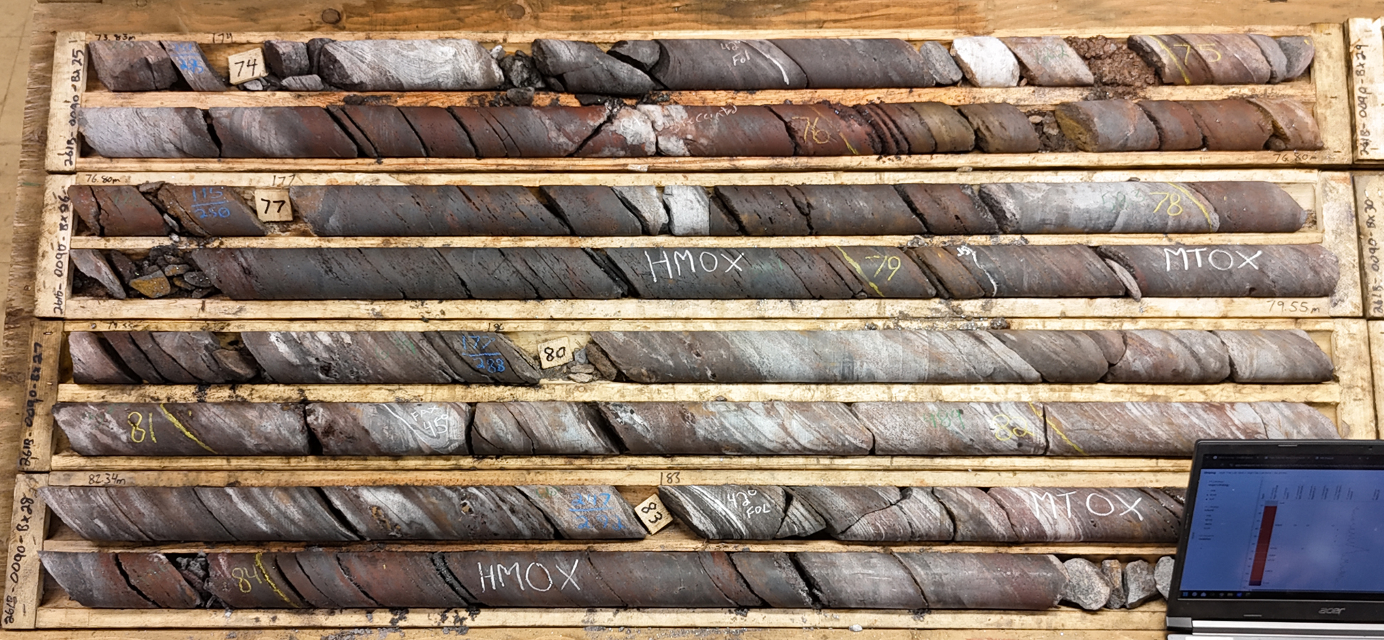
Drill Core on logging table
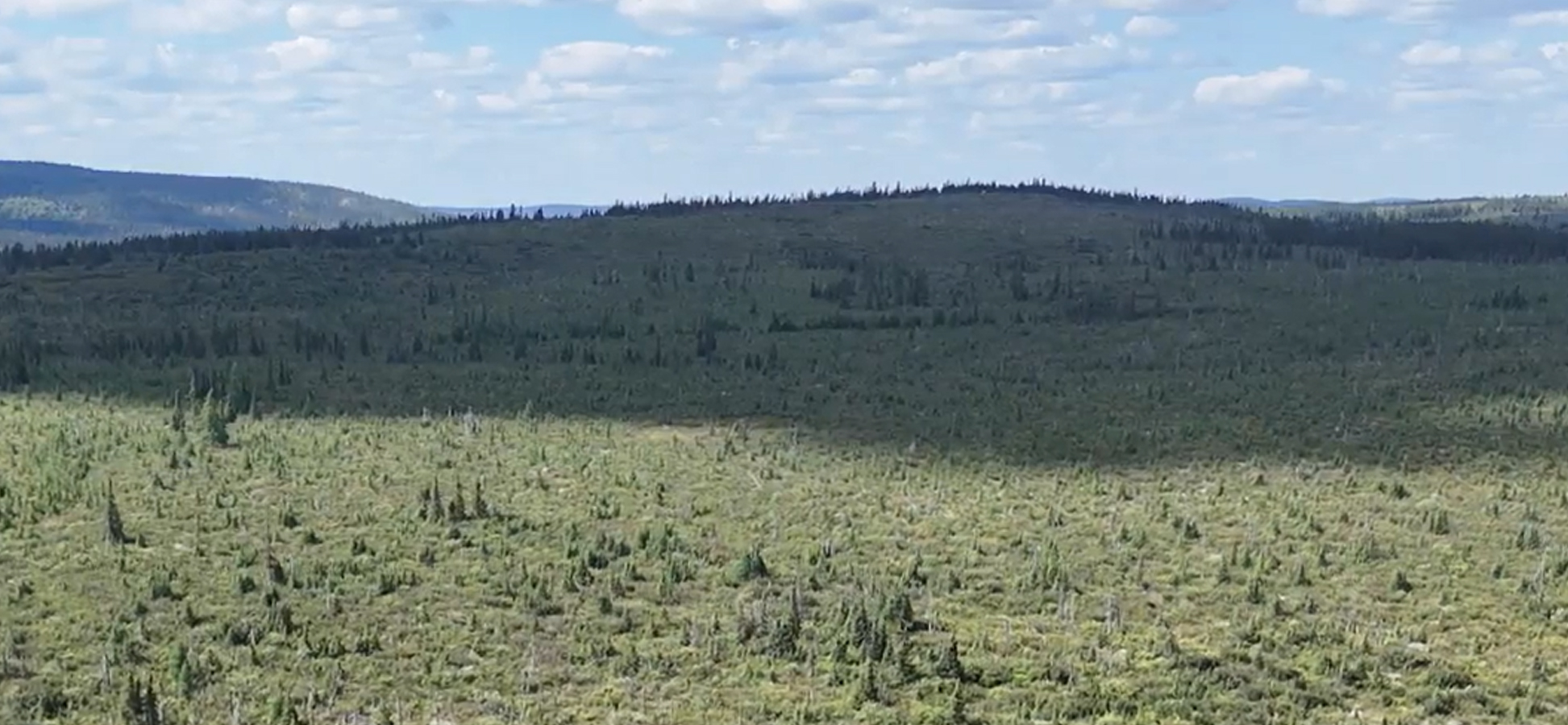
Panorama Of Labrador West Iron project